
CRM Volumetrics Analysis: Achieving Accuracy through Ground Truthing
What better way to stay informed about your company’s geographical
space than through Coastal Resource Mapping’s elite spatial analysis? Our
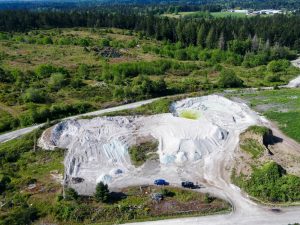
recent aerial drone survey was for a Nanaimo-based forest products
processing company. The goal of the survey was to gather imagery to
calculate the volumetrics for the lime pits on their premises. CRM’s expert
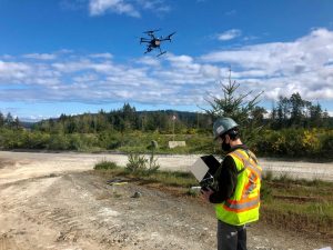
team set up ground control points (GCPs) around the landfill area for the
drone to stitch captured photos with survey-grade accuracy.
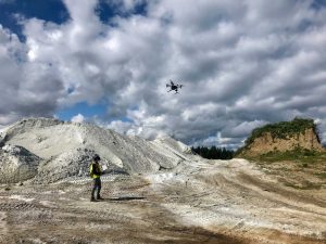
The images are then analyzed by dry volumetric calculations to
determine the contents of the lime pits. The base survey also exhibited data
involving the slopes and cross-sections of the area. CRM specializes in
producing comprehensive data and imagery to confirm the client’s elevation
models and predictions. The imagery captured through continuing visits will
keep the client informed with the most current and accurate data. Our data-
collection services are unmatched and the exceptional choice for your next
land-based project!